Showing posts with label buffalo. Show all posts

Monday, July 17, 2017

A Day Trip to Painted Rocks State Park

It has been quite awhile since Mr. Keith and I have had a day trip away from the KOA and away from chemo. We've seen most of the sights around Missoula, but I discovered a spot on the map where we had not been, the Painted Rocks State Park, south of Darby, Montana. We packed a lunch and set out early to beat the heat. Driving down the Bitterroot is always awe-inspiring, always different in each season. In mid-July the snow is almost entirely gone from the mountain tops and the grasses in the valley are tall and lush. Just south of Darby we saw this small herd of buffalo munching grass and protecting their 2 or 3 little calves.

 We were anticipating what the "painted rocks" would look like. This is it! The State Park is along this man-made lake on the west fork of the Bitterroot River, way out from civilization.


 The park itself was just a few camping spots at the lake-side, populated by a couple of RVs and one or two tents.

We saw this fellow from a distance and hoped he would still be close enough for a photo. I should say he was! He appeared to have no fear of our car pulling right up beside him, in fact, he looked as though he were hoping for a hand-out! We've seen other mountain goats in our travels who were not skittish at all, either.


I am always trying to identify the mountain peaks in the Bitterroot but have only managed to name a few. This one, Trapper Peak, is most unusual because it has pointy tops in contrast to the rounded crests of the other peaks along the way. The State of Montana was most kind in putting up a sign at a roadside pull-out giving the history of area. Trapper Peak is the very highest of all the mountains in the Bitterroot at 10,157 feet. 
 
From the sign:
Trapper Peak has witnessed human activity in the Bitterroot valley for at least 8,000 years. earliest Valley occupants were prehistoric hunters and gatherers. The Bitterroot Salish Native Americans thrived in the Valley until 1891, when they were moved to the Flathead Indian Reservation. In 1805, members of the Lewis and Clark Expedition passed here; followed by traders, trappers, and missionaries. In an attempt to flee from the U.S. Army in 1877, the non-treaty Nez Perce Native Americans passed peacefully through the Valley on their way east. Mining, agriculture, and logging brought settlers, and in 1876 the mountain was named by Granville Lee Shook, a surveyor for the Anaconda Mining Company, for its trapping success. Trapper Peak’s timeless and sturdy form represents history; from the historic travelers of the past, to the modern-day traveler of tomorrow.


Friday, October 16, 2015

Bent's Old Fort

One of the first attractions we wanted to see when we came to La Junta was Bent's Old Fort, which we managed on our 3rd or 4th day here. It lived up to our expectations, and is a place we will want to return to many times. I'll touch briefly on the origins and use of the Old Fort. Charles Bent and Ceran St. Vrain, both seasoned traders and trappers, entered the famous Santa Fe trade in 1829. It soon became evident that a headquarters for the lucrative Mexican and Indian trading should be situated near the border with Mexico, then along the Arkansas River, and in the midst of the southern tribes of Cheyenne, Arapahoe, Sioux, Comanches, Kiowas, and even Blackfeet and Gros Ventres Indians. Actual building began in 1833.

The main items for trade were buffalo hides, horses and mules, and whiskey. We enjoyed seeing this restored merchantile, complete with sleeping cat!

Here is the inside of the fort, a large courtyard in the midst of the two story walls. Though it was a hot day when we visited, we felt a deep coolness inside each room because of the very thick adobe walls.

This is one of the upstairs rooms. 
The fort did a brisk business until the U.S. declared war on Mexico in 1846, and the fort became headquarters for awhile for the army. Charles Bent was appointed governor of the new province which included New Mexico, but was killed in the revolt of the Mexican people. This spelled the end of the era and of the company.

Each of the thick walled rooms inside the Fort had its own fireplace. Very cozy!
 
Within a few years of Bent's and St. Vrain's deaths, the Cheyennes, Arapahoes, and other tribes that had frequented their adobe trading post would all be confined to reservations, and the buffalo herds driven to virtual extinction on the southern plains.
 
Here we see the restored Doctor's office, on the second floor. You can see the huge logs used for the ceiling. These same big logs were above the bottom floor, supporting the second story. The fort had various uses for the next few years, including as a stage station, a post office, and a cattle ranching headquarters. By the early 1900s the fort had fallen into ruin. The site was transferred to the State Historical Society of Colorado in 1954, and complete restoration was begun in 1975. Because of the volumes written by various traders and occupants of the fort over the years, and the artifacts that were dug up, the restoration is quite accurate.
 
Being a cat lover, I had to revisit the merchantile to see if the cat was still sleeping there. He raised his head to thank me for the pets, very content in his old fort. He was not the only animal we saw there. The Fort had a corral in the back with chickens and a few cows and at least one horse. The adobe walls had cactus planted all around the top, thus discouraging thieves from breaking in.

Before we headed back to La Junta we went a little further east to the small town of Las Animas, and there we found this gorgeous Bent County Courthouse in the middle of the dusty, sleepy town. I believe this town is also along the old Santa Fe Trail, which runs through La Junta, too. There is so much history in this area, and we intend to explore it wherever we can! I hope to go into more detail about Bent's Old Fort on future visits.

Friday, June 7, 2013

Big Sky

 Coming home from shopping and from the doctor we thought we would still have time to take the short, 40 mile drive to Big Sky. The sun was shining and it seemed like a perfect day. This scene is looking south from Bozeman, always beautiful.

 After collecting our snacks and our cameras we drove out of the KOA and headed south on the Gallatin Hwy. Keith insists on calling it "The Galatians Road"! We spotted some buffalo on this hill just a short way from the KOA. I wonder if they are raised for meat. I hope not, but I am the first one to order a buffalo burger when I find a restaurant that serves them!

 We caught our first glimpse of Lone Peak as we took the fork in the road to Big Sky.

 Here is the view from the Big Sky area. We never did find an actual town, but only miles and miles of condominiums, hotels and other resort type buildings. It is primarily a ski resort, but it looks like it is used in the summer, too. The entire area is extremely beautiful.

The Gallatin River flows north all the way from West Yellowstone to Three Forks, where it joins the Missouri River, and the Gallatin Road follows it closely for most of the way. We liked these colorful cliffs along the river. We'd hoped to see some wildlife but, besides birds, we saw only a lone coyote. This is a drive to take again someday this summer.


Tuesday, August 21, 2012

I Petted a Buffalo!

There is a big bison ranch just off I-25 near the Wyoming/Colorado border called The Terry Bison Ranch. The whole ranch looks ancient, and some of the buildings are actually from the 1880s. The Ranch boasts an RV park, a restaurant, gift store, and other touristy attractions. We were told the ranch had the second largest herd of bison for meat in the U.S.  The largest herd is owned by Ted Turner, a name everyone knows. (By the way, the terms bison and buffalo are synonymous for these North American animals.) We'd stopped here before, just to look it over, but this time we decided to take the train ride out into the fields "where the buffalo roam". This is the cute little train we boarded.

We had an excellent driver and tour guide. I was tickled to see this unique "chicken house", an old bus. The photo doesn't show too well the myriads of chickens resting in the shade underneath. This type of chicken house can be moved from place to place, always giving the chickens a secure home and at the same time fresh ground. I think it's a great idea!

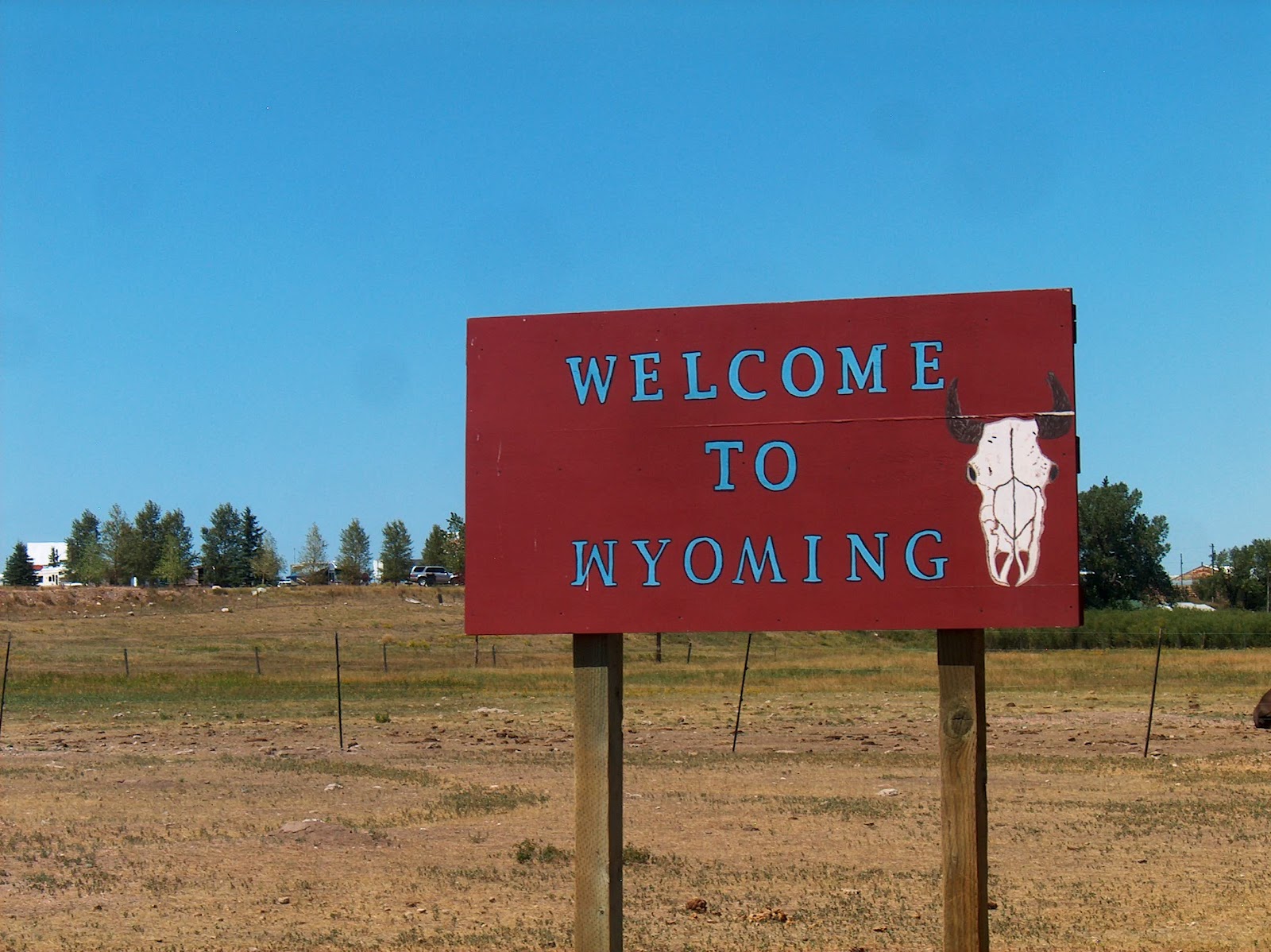
 As our train made a loop around the field we were suddenly surprised to see this sign.

 A moment later, around the loop, we were back in Wyoming!

Finally, we came upon the bison we'd been seeking. This is the biggest guy, the head honcho of the herd.

And this lady was the sweetest and the most adept at begging. We'd all purchased bags of special green (alfalfa?) pellets, just for feeding the bison. All these critters knew to approach the train, and fully expected their treats. Out would come their big, gray tongues and the pellet would disappear, leaving behind a very slimed hand. We all fed them till our bags were empty. What fun!

Just to prove my title, here I am petting a buffalo! The fur on this one's neck was curly, and very soft and deep and cushy. Guess that's how they can withstand the harsh, snowy winters on the prairie.

We had to try this! Ride 'em, Cowboy, Mr. Keith!

My turn! I'm "out on the lone prai-rie"!

And last, a jackalope! We had a great time here, seeing the bison, some camels, llamas, horses, cows, chickens, a mascot turkey, goats, alpacas, and maybe some other critters I'm forgetting to name. We plan to go back with our friends and fellow workampers next week to eat at the Senator's Restaurant, which boasts the best bison burgers in Wyoming. Gee whiz, I feel a little guilty wanting to eat a bison burger after petting a bison!

Tuesday, June 26, 2012

Fort Laramie

After seeing the Oregon Trail Ruts Historic Site and Register Cliff at Guernsey it was a few miles on down the road to Fort Laramie, a National Historic Site. We were pleased to find out that our Golden Eagle passes worked here!

Fort Laramie was established in 1834 near the confluence of the North Platte and the Laramie Rivers. It was first called Fort William for William Sublette, one of the builders. It enjoyed a monopoly on the buffalo trade for many years. In the 1840s the buffalo skin trade was tapering off, and in 1841 the Fort became a stopover for the thousands of emigrants coming through on the Oregon Trail. It was renamed Fort John. In 1849 the U.S. Army bought the Fort to establish a military presence on the plains.The Army changed the name again, to Fort Laramie.This building, originally built in 1874 and then recently restored, was a barracks for the Cavalry during the Indian wars.

I was intrigued with this enormous willow tree, across the road from the Barracks. It had been propped up in several places and gave a wonderful shade on a very hot day. I could imagine children using it to play on, and I surprised a bunny who was enjoying the coolness.

With the end of the wars against the Plains Indians, the Fort lost its importance and was abandoned in 1890. It was sold at public auction. Many of the buildings survived because homesteaders purchased them and public agencies later worked to preserve them. The restored house above, named "Old Bedlam" is the oldest documented house in Wyoming. It served as bachelors' quarters and also housed the Fort commander from 1863-64. It sits in contrast to the ruins of two old officers' quarters. I read that the working Fort sat on treeless grounds. Today there are many trees.

These are the ruins of the hospital from 1873, the first concrete building at the Fort. It was a 12 bed facility with dispensary, kitchen, dining room, isolation rooms, and surgeon's office. Not much left here!

This bow string arch bridge, which replaced early ferries, provided a permanent transportation link between Cheyenne and the territory north of Fort Laramie. It has been restored, complete with its ice breakers. We enjoyed walking across it, picturing the horse and wagons and later the model T type cars. The setting is lovely with huge old cottonwoods along the river bank. The modern bridge is right next to it.


As we completed our tour we drove on down the highway to the next little prairie town, called Lingle. We always explore these towns, checking out the downtown, if there is one, and the back streets as well. At this dead end we were amused to find Lingle's Bumper Crop! Someone had fun with that!

We took a different route home to Cheyenne, making a loop. Mr. Keith saw these bluffs in the distance and had to see if we could get up closer. It was very pretty, and we did make it to the end of the road where there was a reservoir, but that gravel road was the worst washboard we've been on! So ended the last leg of our 200 mile journey into Wyoming history. It was a great adventure back in time along the old Oregon Trail!


Sunday, June 3, 2012

Chugwater, Wyoming

 Today we wanted a short trip that turned out to be about 160 miles round trip. The town of Chugwater beckoned because of the odd name. Though Chugwater is just off I-25 north of Cheyenne we opted to explore a back road, the Horsecreek Rd. becoming the Iron Mountain Rd. It was fairly desolate, with only a few ranches here and there. We were traveling through the Laramie Mountains, elevation up to 6400, a little higher than Cheyenne. Here is a ghost ranch with only the outbuildings still standing. I imagine the house was in the grove of trees to the left. I wonder what caused it to be abandoned?

 We loved this sign at the entrance to Farthing Ranch. When the kids and I lived in Vancouver our neighbors and friends were named Farthing. I wonder if there is any connection? We didn't see a ranch house or other buildings. They must have been down in the draw.


 The town of Chugwater has a population of 244 and the elevation is 5288 feet. We were greeted by this ruined grain elevator next to the railroad track.


 The whole town had an air of days gone by. I'm sure this bank is an old original from long ago, still being used.


 We had planned to eat lunch in Chugwater so we chose, of course, the only place to eat in the whole town. That's Mr. Keith out in front of the Buffalo Grill. We wanted to ask someone about the name Chugwater. We figured it had to do with some thirsty pioneers, but didn't know for sure. It's pretty dry around this part of Wyoming. Upon being seated, we found ourselves at a table next to an old codger who began to talk to us and continued to talk all the way through our meal! Sure enough, he knew the story, and it proved to be kind of gruesome, not what I wanted to hear.

 This is the same story the old codger told us, but copied from Wikipedia.
Some historians hold that the name "Chugwater" is derived from a Mandan account of a bison hunt. According to this narrative, a chief was disabled during the hunt and his son took charge of the hunt or "buffalo jump". Under his direction, hunters drove the bison over nearby cliffs; when the animals reached the ground below, a sound of "chugging" was heard by the hunters. The story concludes with an etymology: since a stream was near the base of the cliffs, the site of the stampede has been called "the place" or "water at the place where the buffalo chug." Could these cliffs be where this awful massacre happened? Or some like them nearby? There is a creek running through the area, as shown by the trees in the photo. I don't like the story, would much rather it had been about some thirsty pioneers or ranchers. But that's how it was.

 We saw many of these lovely wildflowers along the way, growing in the sandy hillsides. The last time I saw these I was in the Black Hills of South Dakota. I was able to find them on my iPad app, "The Audubon Guide". They are White Prickly Poppies. The flowers are definitely poppy-like, and the greenery is like a thistle. They are safe from roaming cattle and pronghorns because of the stickers!

  We traveled home the same way we had come, to see the land from the opposite direction.  We came across this tiny school house, dated 1919 to 1936 and labeled Capitol Vista School. Children must have come from far to attend here!


 Last, but not least, a common sight in Wyoming is a field with horses. After all, it is the "Cowboy State"!


Sunday, December 25, 2011

Quiet Times

 Since Mr. Keith hurt his back and had surgery, we've stuck very close to home and led the quiet life. There have been no days off to take sight-seeing trips in our beautiful surroundings, so I've snapped photos where I can. Here is our itty bitty Christmas tree, complete with nativity scene, gifts from daughters, a snowman, and a festive bear.


 The workamping lifestyle is one of great fun and adventure for us, the only down-side being so far away from family. God has blessed us in this place with the nicest people in the world, it seems. There is a close knit country concern for neighbors and folks in need, which we are during the holidays! A co-worker invited us to join her family for a Christmas Eve dinner, a true blessing for two old coots without our own family nearby. On the way there, a 12 mile drive out on the prairie, we came across these buffalo foraging for food in the snow. I had to stop and get photos! These critters are raised on a ranch near Byers, Colorado. We'd seen them before, but not up close, and not posing so picturesquely in the snow.


 These new friends were our wonderful hosts for Christmas Eve dinner, the Gates, a caring couple with big hearts and an open home. They made us feel so included.


 Part of the afternoon's fun, props for funny photos!


 Christmas Day, another quiet time at home. I took a walk around the campground in the snow, and was intrigued by these semi-symetrical tracks, seeming to point towards the two trees in the background. Gotta take pleasure in small things!


I let myself into the closed office-store to check on our campground pet, Callie. (How many calico cats have you seen who are named Callie?) She wanted to go outside but wasn't so sure when she felt the cold air. I'll go back later to let her in again.

So passes another calm day while Mr. Keith recuperates a little more. Back to work tomorrow for me!